Sunday, June 9, 2024
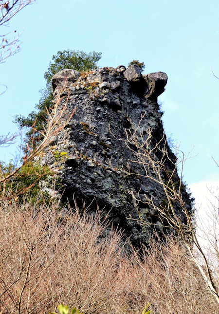
Oni no Shitaburui Gorge
Thursday, April 20, 2023
Kankakei Gorge Ropeway Shodoshima
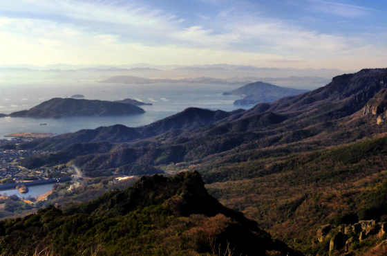
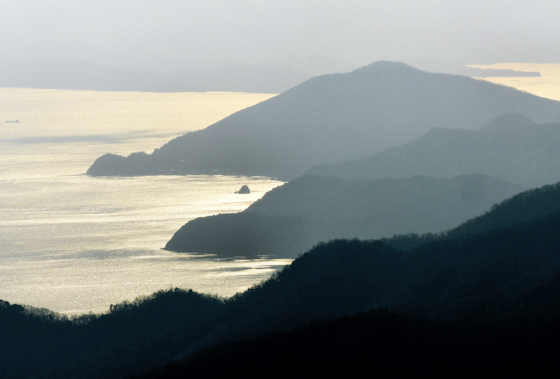
The view from the top of Kankakei Gorge, which is located roughly in the middle of Shodoshima Island.
Sunday, February 19, 2023
Kankakei Gorge East Trail
Kankakei Gorge East Trail
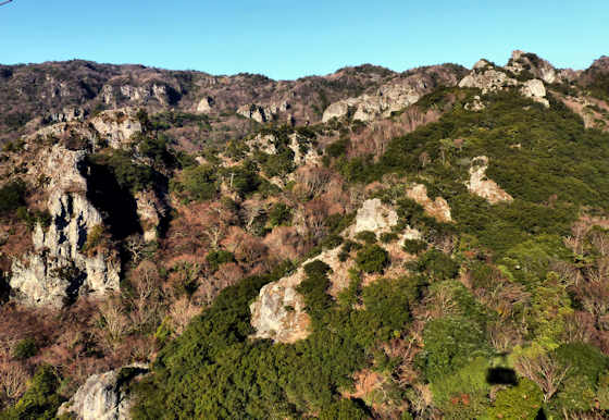
Kankakei Gorge on Shodoshima Island is a major scenic spot of the island and included in the top 100 scenic spots of Japan. It is particularly popular in the autumn when it is a blaze of colors.
Formed by 2 million years of erosion, Kankakei, which means "cold mist valley", is home to a dramatic landscape of cliffs, spires, and strangely shaped rock formations. It is commonly viewed from the ropeway which runs for almost a kilometer and climbs about 300 meters to the top.
There are two trails for those who wish to explore the gorge, the West, or Front Trail, and the East, or Back Trail. The latter is about 3k in length and starts from the bus stop very near Hotogegataki, the 20th temple on the Shodoshima pilgrimage.
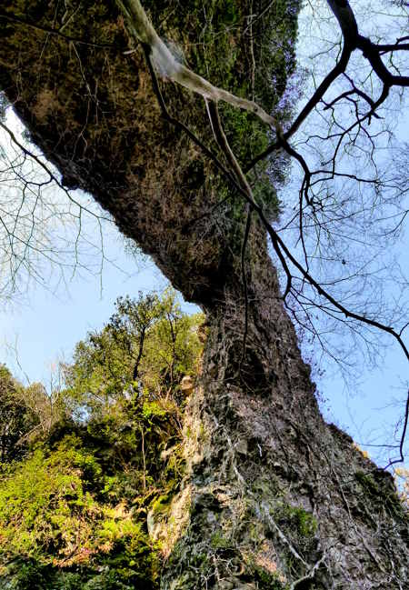
About halfway up the trail you pass underneath a huge natural arch or bridge where you can visit Sekimondo Temple, number 18 on the pilgrimage, and like Hotogegataki, a curious cave temple.
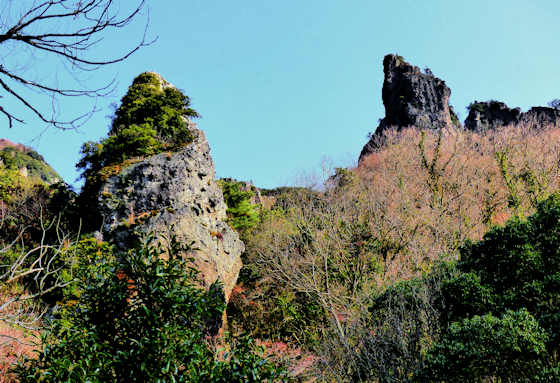
Many of the rock formations you see on the way have names, with the one below looking very much like the coffee pot rock formation near Sedona in Arizona.
As you climb the views become more and more expansive as you get closer to what is not only the highest point on the island but also the highest point in the Seto Inland Sea.
I first visited on the second day of my walk along the Shodoshima pilgrimage. The previous post in the series is Sekimondo Temple 18.
Sunday, December 1, 2019
2019 Fall Colors Part 3 Chomonkyo Gorge & Ryuzoji Temple
For the second part of my search for the Fall colors this year we headed to Yamaguchi. First stop was Chomonkyo, a pretty gorge in the mountains, and a section of the Chugoku nature Trail.
It was a glorious day with not a cloud in the sky. At the entrance to the gorge some maples had been planted, but most of the mountainsides were mottled with browns and yellows.
Next we headed to Ryuzoji, a temple at the head of a small valley outside of Yamaguchi City. Here there was a mix of maple and Gingko, though it was not at peak season yet.
The temple is known for a particularly old and large Gingko tree. There is also a waterfall and many statues of Fudo Myo.
Friday, February 1, 2013
Yabakei Gorge & Aonodomon
Honyabakei is a small town south of Nakatsu in Oita Prefecture. in 2005 the town was merged with Nakatsu.
The draincover depicts Yabakei Gorge and Aonodomon.
The gorge was created by the Yamakuni River cutting through the biggest volcanic plateau in Japan.
The result is some spectacular rock formations and sheer cliffs that are particularly popular in the Fall season.
Aonodomon, which means "blue tunnel" is an almost 200 meter long tunnel carved into the base of the cliffs. According to legend it was carved by a single monk named Zenkai using a hammer and chisel and took him 30 years to complete.
Earlier in his life Zenkai had committed a murder and to atone for his sins her carved the tunnel to make the rout to a local shrine safer for pilgrims.
Thursday, December 30, 2010
Takachiho Gorge
This manhole cover is one from the town of Takachiho in Miyazaki Prefdecture, Kyushu.
Takachiho is famous as being the place where the myths of Japan have the ancestors of the Imperial family descending from "The High Plain of Heaven" and beginning their invasion and subjugation of Japan.
The design of this draincover shows the Takachiho Gorge, cut by the Gokase River through the volcanic basalt rock.
In the middle of the gorge is the Minainotaki waterfall that drops 17 meters into the river.
It is possible to rent little rowboats, 1,000 yen for 10 minutes, and paddle around in a tiny roped-off section of the river, but it does allow the best views of the falls.
The place is very, very popular with a constant stream of tour buses arriving and disgorging thousands of tourists. When I got back I learned from friends that Takachiho is considered a "Powaa Spotto".
One may think that this equates to what we might call a Power Spot, but with a little research I found something curious about Japanese Powaa Spottos. I would think of a power spot as say Sedona, Lourdes, the Pyramids,... places connected to the earths energy that transcend the country they are found in. But is seems for the Japanese it is a little different. Many of the Japanese powaa spottos; Takachiho, Izumo Taisha, Meiji Shrine, etc, are all places intimately connected with the State and Emperor System. Places that do no transcend the country they are in. They are political. As if Abraham Lincolns grave was a power spot, or the beach Columbus first landed on.
Anyway, Takachiho Gorge is really quite pretty. especially when the sunlight penetrates the gorge and illuminates the spray from the falls.
There is a path that runs along the gorge for about 600 meters.
Monday, February 8, 2010
Red hats & bibs: cliffside
Buddhist statues wearing red hats and bibs can be found all over Japan. In wayside shrines and altars there will be alone or in small groups. In larger temples there may be many of them in lines.
In Tachikue Gorge on the Kando River a few k south of Izumo City, there are hundreds of them arrayed along a cliff for about 500 meters.
There are 1,000 statues of various buddhas, and 500 statues of Buddhas disciples.
This area was a centre for Yamabushi until Shugendo was outlawed in early Meiji.
Buses from Izumo Station stop along the gorge.


